From The Salisbury Museum Blog by volunteer Jane Hanbidge
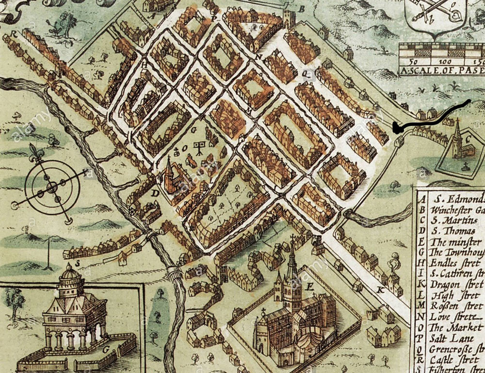
In the medieval period (until about 1550) St Ann Street was called St Martin’s Street. Then, as now, it led straight down the hill (from east to west) from the city boundary, crossing Exeter Street (then called Drakenhall or Dragon Street) to enter the Cathedral Close through St Ann’s Gate.
St Martin’s Church was, and is, on the rise to the eastern end (now on the far side of the ring road). It was founded in the ninth century, before the cathedral, which makes the settlement there one which existed while Salisbury was still Old Sarum.
One can imagine early travellers, having come through the New Forest or north up the Avon perhaps, being delighted to see the church tower ahead and perhaps stopping nearby in some kind of accommodation, or for refreshment, and to change horses, before moving on.
St Ann Street may well have been built on the line of a very ancient route, just clear of the floodplain on the north side of the Avon (see photo, top right).
It was at the top of the street that the city ditch, marking its boundary, was finally completed in the early 15th century. The church found itself on the outside of the ditch. Perhaps this was when the old name (St Martin’s Street) began to fall out of use.
There was, at some time, a bar which could stretch across the road, not usually needed as a defence, but a boundary, perhaps to control trade in and out. At the eastern end of Winchester Street and the northern end of Castle Street, gates had been built, substantial enough to be recorded as dwellings in the later part of that century. The ditch and the position of the bar in St Ann Street are now under the ring road.
Early maps (e.g. Speed, 1611, see above) suggest that there were only a very few buildings on the south side of St Ann’s but it is uncertain how accurate those maps would have been. The boggy moor (Bugmore) there may have made it, initially, unattractive for dwellings.
By the late 1600s, buildings which had appeared on the south side of the street had long narrow gardens, reaching down to one of the watercourses which drained out of the centre of the city towards the Avon. Here the river runs along the southern edge of the city and was crossed at Ayleswade Bridge (built 1244) by traffic entering from the south and south west.
The land beyond the gardens was meadow and pasture, down to the river. Deeds which are held at Wiltshire and Swindon History Centre record the Pelican Inn in Tanners in the 1600s, later known as St Ann Street, Salisbury. An earlier blog suggested that It was known as ‘Tan Street’, as a corruption of St Ann Street, but it seems it was an area for tanning and this may be the reason it carried that name for a while.
The 1841 Census shows a tannery in the immediate area and there was certainly a tannery there in 1687, mentioned in a Will of that date.
On the north side of the street were more buildings, tightly packed, many of them shops and workshops. Another hostelry, possibly on the corner of Love Lane and St Ann Street, was called the Pot and Lynbeck. It was later called the Fleur de Lis, and by 1822 it was the Bird in Hand. We know from our own experience that inns and pubs are constantly changing their names. This Bird in the Hand is not the one in North Street.
In his Will, dated 1699, Robert Sutton, a clothier, set up three messuages in Tanner (now St Ann) Street as almshouses for three poor weavers and their wives. This is a reminder of the early importance of the textile industry in the city and a reminder, too, that by the 17th century it was in decline.
Nevertheless there are upwards of 20 weavers listed in the area in the 1841 Census, about half of them “Silk Weavers”, and several very elderly. Some of the latter may indeed be the residents of the almshouses, but is not clear from the census entries. In 1833, applications for admission from weavers were said to be numerous. The almshouses closed in the 1870s.
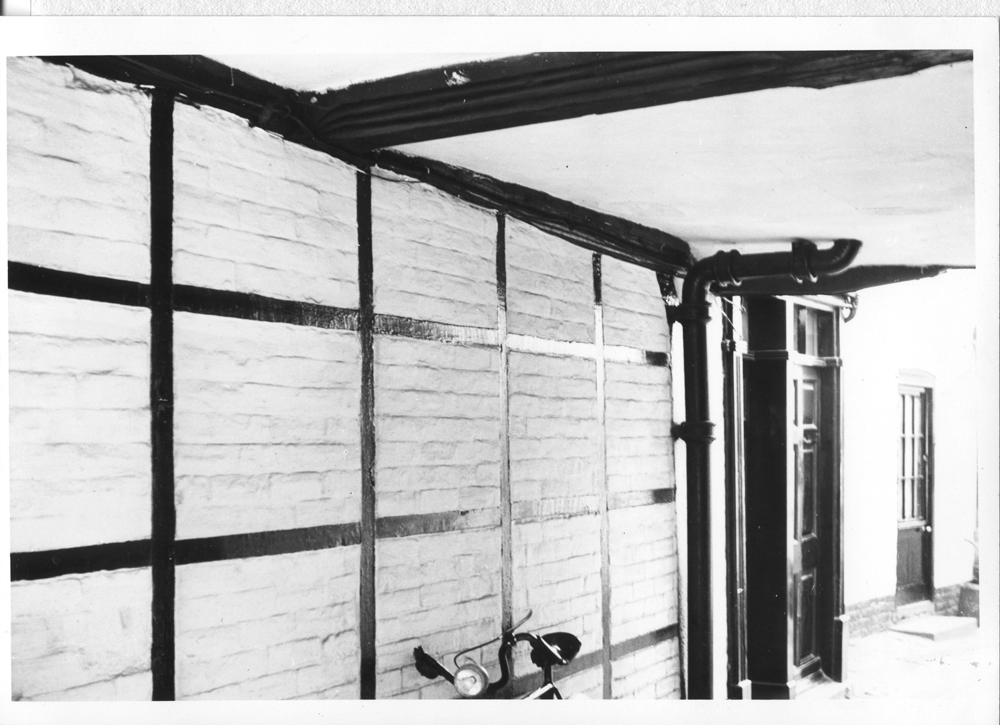
There were courts and alleyways behind the houses on each side of the street, as there are now, but perhaps less salubrious than today. Prospect Place, even today tucked behind a wonderful series of half-timbered Medieval buildings in St Ann Street was, in the 19th century, home to labourers and butchers, as was Green’s Court, now a pleasant area of smart new town houses.
Near the west end of St Ann Street, at its present-day junction with Brown Street, there was, in the medieval period, a bridge (Friar’s Bridge) to take the ‘traffic’ (such as it was) over one of the infamous Salisbury street channels which ran all the way down Brown Street, along Friary Lane (once called Freren Street) and onto Bugmore.
On Bugmore, a paper mill is recorded at this time, perhaps as the channel opened up into a stream prior to joining the Avon nearby.
The street was very fashionable in the 18th century, evidence of which is clear to see today. There are some beautiful houses from that time.
Number 84, which was at the top of the street but demolished in the 1960s had five bays to the front and a stone doorway with Roman Doric columns, entablature and pediment.
Inside there was a lot of panelling, large rooms on three storeys, sweeping decorated staircase and attic and cellar. But by the 19th century it had been converted to a home for destitute children, so things were quickly in decline.
No 82 is also a grand house, until recently the Three Chequers Surgery building, again with three storeys, beautiful exterior, cellars and so on, similar to others down the street.
It is probably the one in the 1861 Census – Head of Household, Henry Hodding, solicitor, with his family and six servants (see opposite page).

HistoryNews
Salisbury in the medieval period revealed in museum archives
salisburyavonMarch 27, 20230 Comment0
Related Articles
CrimeNews May 8, 20240
Tidworth landlord Frederick Allard, 73, preyed upon vulnerable women
A 73-YEAR-OLD Tidworth man used his position as a landlord to prey on vulnerable…
News May 7, 20240
Police appeal over missing Gracie, 13, last seen in Downton
POLICE have launched an appeal to trace 13-year-old Gracie, who has been reported missing…
News May 7, 20240
Trio sentenced over break in at Salisbury FC stadium
THREE youths have been sentenced after breaking into Raymond McEnhill stadium – home of…


Leave a Reply